
Hiking · Cycling · iPhone and Apple Watch
Head outside. Leave the noise.
Routes finds trails near you, plans your loop, tells you where to go on the way and keeps everything you have ever walked or ridden. Calm, on your iPhone, and only shared when you choose.
For iPhone and Apple Watch · in 13 languages

Photo: Galen Crout · CC0
.jpg)
How Routes works
From idea to memory.
1Discover
Waymarked trails, right around you.
Routes shows the signposted hiking, cycling and MTB routes nearby, with length, time and elevation. Closest first. If the start is further away, Routes tells you how to get there by car, transit or bike.
- Hiking, cycling and MTB
- Loop or point to point
- Your own regular loops on top


2Plan
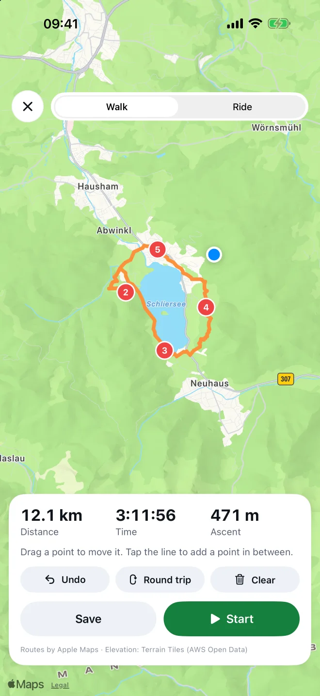
Tap, and the line follows the paths.
Drop a few points on the map. Routes lays the route along roads and trails and works out distance, walking time and ascent. Move points, close a loop, undo: all with one finger.
- On foot or by bike
- Time from distance and climbing
- Save it or head out right away
3On the way
The map you know from paper.
On the trail you see the official topographic map with contour lines, huts and summits. Spoken directions tell you when to turn, when you’re off route and how to get back, even with the screen off.
- Voice guidance in the voice you pick
- Apple Watch with heart rate, map and its own recording
- If the watch drops out, the iPhone keeps recording

4Look back
Every tour, with everything that belongs to it.
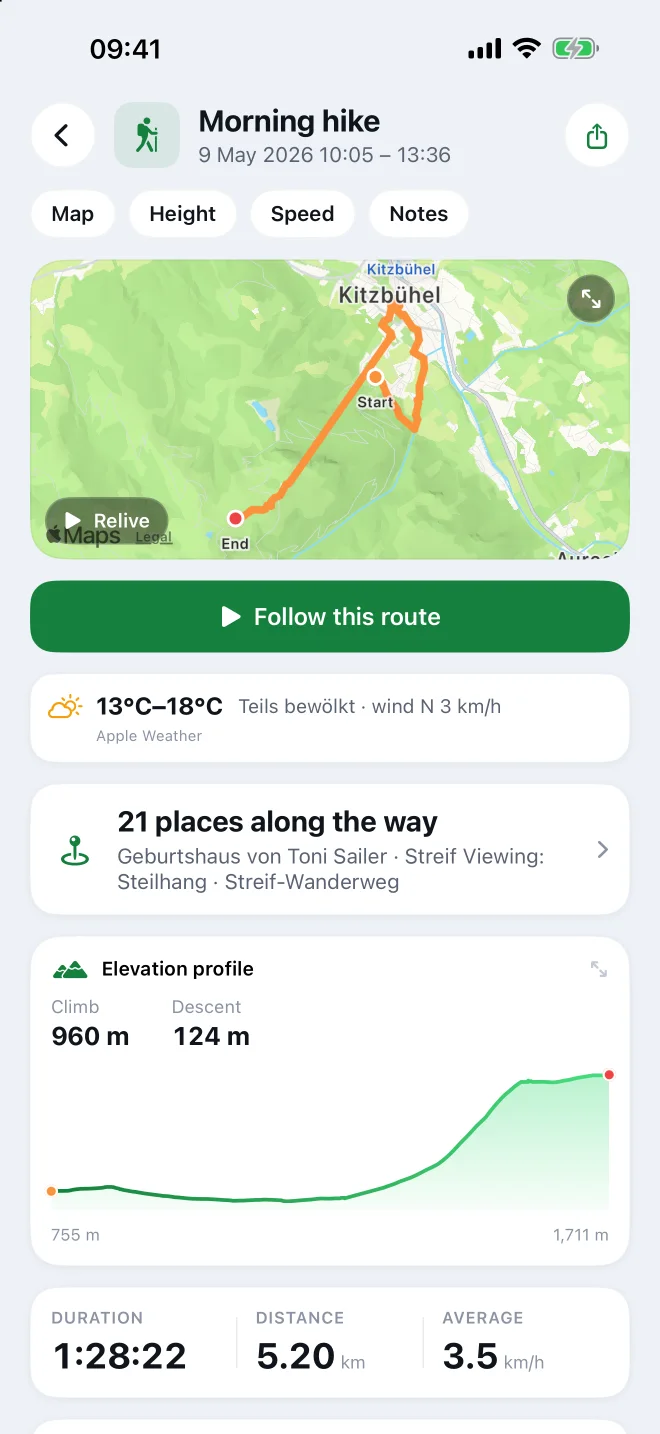
Afterwards it’s all in one place: the route, the elevation profile, the weather that day, split times and the places you passed. One tap and you walk the same loop again.
- Places along the way with their kilometre
- Photos where you took them
- “Relive” as an animation

Made for the hours outside. Not for the minutes on your phone.
Photo: Reinhold Möller Ermell · CC BY-SA 4.0

Regions
Waymarked trails where you love to be.
Selected areas with their signposted hiking, cycling and MTB routes from OpenStreetMap. In the app you’ll find them everywhere, with time, elevation profile and navigation.
 Schliersee & SpitzingseeBavariaHiking 53 · Mountain biking 10
 KitzbühelAustriaHiking 8 · Mountain biking 26
 BerchtesgadenBavariaHiking 77 · Mountain biking 4
 ZermattSwitzerlandHiking 29
 Garmisch-PartenkirchenBavariaHiking 36 · Cycling 3
 Saxon SwitzerlandSaxonyHiking 49 · Cycling 6
 Harz MountainsSaxony-AnhaltHiking 82 · Mountain biking 7
 VeluweNetherlandsHiking 26
- Plan your own routes: tap points, the line follows the paths, with distance, time and elevation
- Voice guidance when following a route, even with the screen off
- Pick the voice for the directions yourself
- Off route: Routes shows and tells you the way back
- Edit your planned routes afterwards
- Export tours as GPX, with elevation and time
Questions
In short.
When is Routes coming?
Routes is nearly done and being tested outdoors. Send us a note and we’ll let you know when it’s in the App Store.
What does Routes cost?
That isn’t decided yet. We’ll say so clearly before you download anything.
Are there offline maps?
Not yet. Maps load and are kept on your iPhone for a while; proper downloadable offline maps come later.
Do I need an Apple Watch?
No. With just your iPhone you plan, navigate and record. The Watch adds heart rate and energy, and lets you start from your wrist.
Is Routes on Android?
No. Routes is built for iPhone and Apple Watch and uses Apple Health as its store.
Where is my data?
On your iPhone and in Apple Health. Only what you share yourself is on our own server. Apple Health values such as heart rate and energy never are.
Which sports?
You record walks, hikes, runs and rides. Skiing and cross-country skiing are read from Apple Health too.


Ready when you are.
Leave us a note and you’ll hear from us as soon as Resa Routes is in the App Store.
Photo: David Marcu · CC0
.jpg)